


- Home
- GIS Expert
Who is a GIS Expert?
GIS is waking up the world to the power of geography, this science of integration, and has the framework for creating a better future ~ Jack Dangermond
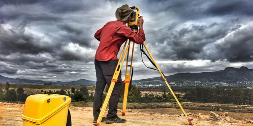
GIS Experts use specialised technology to analyse and visualise both spatial and non-spatial data. By integrating maps, satellite imagery, and various datasets, they contribute to solving real-world challenges such as flood forecasting and urban planning. In this role, you will work with advanced software to collect, manage, and interpret geographic information. Your responsibilities include creating maps, developing databases, and establishing data standards to maintain accuracy and consistency.
GIS Expert in a Nutshell
The role and responsibilities of a GIS Expert include analysing, visualising spatial data using tools such as ArcGIS and QGIS to help in decision-making. These experts work with satellite imagery, GPS Data, and geospatial databases to create detailed maps and models. They play a crucial role in urban planning, disaster management, and environmental monitoring.
Quick Facts for GIS Expert
-
Industry
Technology
-
Average Salary in India
₹24830
-
Suitable for
Male, Female, Others
Gender is a non-factor when it comes to pursuing a career as GIS Expert; there are no gender barriers in this profession. Those who are interested in this career need to develop an expertise in GIS technologies, including GPS, remote sensing. They should also know how to interpret satellite imagery to create accurate maps.
-
Any special needs
No
A career as a GIS Expert might not be suitable for candidates with certain special needs. The reason is, the role involves working in the field, which might also require a level of physical fitness. The individual also needs to be good at researching and collecting data from multiple sources.
Table of Contents for GIS Expert
What is the role of GIS Expert?
GIS Expert manages the database, examines spatial and non-spatial data, and creates thematic maps using tools such as ArcGIS and QGIS. GIS Experts work with satellite imagery, coordinate data, and digitised maps to support sectors such as urban planning, health, transportation, and environmental management. The role also includes emergency vehicles, identifying business locations, and conducting demographic or market research.
Create products
A GIS expert uses GIS software to analyze GIS databases for spatial and non-spatial information. He or she stays involved in launching online and mobile maps for general people. A background in computer science and programming is required to work as a GIS expert. Knowledge of programming languages is required for desktop mapping to automate processes, creating customized tools and workflows.
Research work
The gis expert job description includes conducting research to obtain and expand existing datasets. A GIS expert compiles the geographic and demographic data gathered from various sources to create online and mobile maps for public consumption. He or she consults with external stakeholders to access fieldwork, censuses, maps, satellite, and aerial imagery.
Collect data
The role of GIS expert is to collect, manipulate, and update databases. He or she compiles the statistical data to incorporate data to prepare reports for documentation. A GIS expert applies cartographic principles to enter new map data. He or she is responsible for maintaining GIS system hardware, software, and peripherals. A GIS expert analyzes and models relationships between geographic datasets.
Providing information
A GIS expert is responsible for presenting information to clients and other stakeholders in a written or verbal manner. He or she analyzes the data and maintains a record. A GIS expert prepares a report with the records and documents it for presentation to other stakeholders and clients. He or she verbally describes the context of information to clients and stakeholders for better understanding.
Types of a GIS Expert
Here, we have provided the various types of a GIS expert or various GIS expert career options or related careers.
Civil Engineer: A civil engineer’s work responsibilities include conceiving, designing, building, supervising, constructing, and maintaining infrastructure projects and systems. A civil engineer works in the private as well as the public sector. He or she also oversees the construction and maintenance of roads, buildings, airports, tunnels, sewage treatment, and water supply systems.
Data Analyst: A data analyst's work includes collecting and cleaning data to reveal patterns and perspectives of the market. The day-to-day role of a data analyst varies on the basis of the company, business, or type of data analytic specialization want. Data analysts can use business intelligence software such as tableau, and programming to build dashboards, and design and manage relationship databases and systems for multiple departments throughout their organization.
Environment Specialist: An environmental specialist is a scientist who studies the impact of the population on the environment. He or she observes how the development model has affected the ecosystem. He or she identifies the issues and recommends solutions for them. An environmental specialist may work for a private organization or government department. He or she ensures that specific regulations regarding air, water, and soil are met.
Data Scientist: Data scientist can be defined as an analytical data expert who can solve complex and critical problems with technical skills. A career as data scientist is all about analyzing, processing, and modeling data and then using it to interpret the results to create actionable plans for business models, companies, and other organizations or industries.
Geographer: A Geographer is a scientist who studies geographical aspects of land, nature, and the earth. He or she stays involved in the study of the inhabitants and features of a region. A geographer is responsible for studying cultural, and political structures of land in relation to geography. He or she prepares a report based on their findings and presents it to other stakeholders or makes it available in the public domain for scholars to study.
What is the workplace/work environment of GIS Expert like?
GIS Experts work in office as well as laboratory environments and outdoors during fieldwork or research activities. They play a key role in construction projects and civil engineering by providing spatial data. GIS Experts also help in demographic studies.
Does GIS Expert require travelling?
Likely
In a career as a GIS Expert, travel requirements vary based on the organisation and project needs. Professionals may occasionally travel to attend meetings, participate in press briefings, or conduct field surveys as part of their responsibilities.
Employment Shifts
Full Time
There are limited work-from-home opportunities and they generally do not have on-call or part-time options. Individuals have to work full-time time and there has to be a strong sense of commitment due to the nature of the work and project responsibilities.
Employment Nature
Contractual, Permanent
GIS experts have permanent as well as contractual employment options. The length of contracts depends on the role and the organisational needs. Short-term contracts are generally for one year and can be extended based on the individual candidate’s skills and performance.
Work Place
On-Field, Office
A career as GIS expert involves either working in an office environment or in the field. GIS Experts may work on computer systems using specialized software.
Presence in Geographical Area
Semi-urban, Urban
GIS Experts will primarily find work opportunities in Metro Cities that have a strong IT presence, smart-city initiatives and a high demand for geo-spatial services. Urban Centres also have better infrastructure, diverse projects and aan ctive professional network. Although semi-urban areas are gradually providing job opportunities to GIS Experts, urban centres remain one of the most attractive job locations.
Time Pressure
Not Likely
The work pressure is generally moderate in this field. Most GIS Experts work in indoors in offices or labs where they take care of data analysis, mapping, and research tasks. They generally work for around 40 hours a week. When there are project deadlines to be met, in those cases, work hours can be irregular, and one might have to work beyond normal working hours.
Overtime Details
GIS Experts generally work a minimum of 40 hours per week. When projects and deadlines are to be completed, one can work for about 45-50 hours per week as well. Based on the project demands, individuals can also work during the day, evening, or night shifts.
Weekly Hours of Work
Min 45 Hours
A career as GIS expert involves working 8 to 9 hours a day. Sometimes it may require overtime in several situations. A GIS expert works 35 to 40 hours a week.
How to become a GIS Expert?
Steps to become a GIS Expert
In the next few steps, we are going to discuss on how to become a GIS Expert in India. From choosing the right education to gaining practical experience, the following steps will give an overview of the path leading to the career.
What are the skills and qualities required to become a/an GIS Expert?
Individuals who want to work as geographical information systems officer must learn a certain set of skills. We have included some of the abilities needed to become GIS experts below.
Database Knowledge: GIS Experts should be able to understand the special case of spatial data such as how it works or its internals. He or she must know how several operations are carried out when they are applicable. While there are also other operations that do not produce valid results running in the software.
Data Conversion: GIS Experts are often required to convert data from older sources or multiple sources in a common format or common schema. It requires us to work with the GPS data and perform data corrections if needed. A GIS Expert has to maintain data, archive it, and ensure its quality.
Analytical Skills: A GIS Expert requires to perform GIS analysis to solve various problems. A GIS expert should be able to extend and alter the standard analysis. Remote sensing skills are required for effective data analysis for both types of data vector or raster data.
Programming Skills: A GIS Expert must possess expertise in programming languages. Programming languages are required to build workflows or custom solutions. Python is such a scripting language preferred by both ESRI and the open-source community. C++ is beneficial to work in multiple environments.
Critical Thinking: Individuals in the GIS Expert career require effective analytical and critical skills. He or she faces various issues related to mapping and other analytical issues. It takes years of experience to manage city streets, modeling storms, and combine the datasets taken from multiple sources into one centralized catalog.
Project Management: GIS Experts have to work on multiple projects in the same time frame. He or she has to juggle between different projects. It becomes difficult to fulfill the expectations of the stakeholders while working on numerous projects simultaneously. GIS Experts have to ensure the completion of the project on the issued deadline.
Communication Skills: Individuals in the GIS Expert career work in a team. They have to effectively communicate with all the other members to avoid any mismanagement. Individuals have to coordinate with other members of the team and stakeholders to update the project.
Which certifications and internships can be helpful in becoming GIS Expert?
We have listed here GIS expert certification courses.
Subject : Geology: Paper - Metamorphic Petrology & Thermodynamics | |
Mining Technology, Safety, Legislation including the Latest Amendment |
Internship Availability
When it comes to a career as a GIS expert, internships are very important since they provide an individual with practical knowledge about the field. The employers wish to hire those candidates who possess prior experience in GIS or have gone through practical training in GIS. Individuals are required to opt for internships after completion of their academic course as it brings them enormous industrial exposure. The candidates get hands-on knowledge through practical training during internships. The work responsibilities of interns may vary from organization to organization. An intern is required to assist GIS analysts in updating land use and land cover data. Interns work with elevation data. They may be involved in developing flood risk products or performing flood risk assessments.
Career Path Progression for GIS Expert
CAD Drafter: A CAD drafter creates schematics required in the manufacturing of products or to construct buildings. He or she works on computer-aided design software. A drafter may specialize in several areas such as civil, mechanical, or electrical drafting.
GIS Technician: A GIS technician is responsible for digitizing the information on georeference paper and digital map images. He or she traces lines that interpret roads and streams, polygons like buildings or lakes. A GIS technician’s work requires attention to detail.
Surveyor: A surveyor conducts surveys to determine legal properties. They gather the data and make a report by compiling legal documents for buildings, map-making, and real estate projects. There are several types of surveyors as per their area of specialization such as land surveyors, site surveyors, or property surveyors.
GIS Expert Jobs and Salaries
CAD Drafter
Contractual/Permanent
- Average Salary 21627
Job Description
A CAD Drafter is a professional whose work responsibilities involve converting designs into technical drawings with the usage of a CAD Software. He or she ensures construction plans for a building or other structure are technically correct. The role of a CAD Drafter involves collaborating with Architects, Designers, Surveyors, Engineers, and other professionals.
Salary Description
The salary of a CAD Drafter varies depending on his or her skills, work experience, and other factors. The entry-level experience average CAD Drafter salary is Rs. 234,220 per annum. While a senior-level experienced average CAD Drafter salary is Rs. 499,063 per annum in India, according to payscale.com.
Surveyor
Contractual/Permanent
- Average Salary 25863
Job Description
A Surveyor's work responsibilities include measuring the land features concerning its depth, shape, and other reference points. He or she examines previous land records in order to verify the data from on-site surveys. A Surveyor prepares maps, reports, and presents results to clients.
Salary Description
The salary of a Land Surveyor varies depending on his or her skills, experience, size, and structure of employing organization. An early-career Land Surveyor earns an average salary of Rs. 294641 per annum. A senior-level experienced Land Surveyor earns an average salary of Rs. 390828 per annum in India, according to payscale.com.
GIS Technician
Contractual/Permanent
- Average Salary 27000
Job Description
A GIS Technician's work responsibilities include creating customized maps and GIS (geographic information systems) applications. He or she compiles and integrates new cartographic data, draws maps, and enters the data into the GIS database.
Salary Description
The entry-level salary of GIS Technician in India is around Rs. 27000 per annum. However the salary may also be higher depending on the individual skills set.
What is the job outlook for GIS Expert?
There has been an increased demand for GIS professionals due to the availability of geospatial data and map-based technologies. Even the global market is expanding rapidly, which has created opportunities for surveyors, cartographers, GIS analysts, and experts across government, environmental, and tech sectors. For career growth, the individual needs to have an early exposure to GIS tools, software skills, and a fundamental understanding of web programming.
Frequently Asked Questions for GIS Expert
Que. What is the average fee of B.Tech. in Geoinformatics?
Ans.The average fees of B.Tech. in Geoinformatics range from Rs. 60,000 to Rs. 2,00,000 per annum.
Que. Are there any short term courses other than degree courses related to GIS (Geographical Information Systems)?
Ans.There are numerous short-term certificate and diploma courses. The Indian Institute of Remote Sensing offers PG diploma courses that provide detailed knowledge of remote sensing, satellite image analysis, Geographic Information System (GIS), and Global Navigation Satellite System (GNSS) technologies. The students who have completed their graduation or post-graduation in science are eligible to apply for PG diploma programmes offered by the Institute of Remote Sensing.
Que. What are the top colleges to study in order to become GIS expert in India?
Ans.Some of the top colleges in India to become a GIS expert include SRM Institute of Science and Technology, Chennai, Vellore Institute of Technology, Vellore, Christ University, Bangalore and Indian Institute of Technology Madras.
Que. Is GIS in demand in India?
Ans.Yes, GIS (Geographic Information System) is in high demand in India due to its widespread applications in urban planning, agriculture, disaster management, and more.
Que. Is GIS hard to study?
Ans.GIS can be challenging to study for some due to its technical nature, but with dedication and the right resources, it can be a rewarding field to pursue.
Que. What is the average salary of a Geographer?
Ans.The average salary of a Geographer is Rs.515000 per annum.
Que. What is the minimum basic requirement of education for GIS experts?
Ans.The candidates are required to complete a bachelor’s degree in geology, geoinformatics, Geographic Information Systems, or remote sensing to establish a career as a GIS expert.
Que. What are the other related industries to Geographic Information Systems?
Ans.The GIS scholars can opt for a career in agriculture and urban development industries other than the GIS industry.
Que. What is GIS specialist?
Ans.GIS specialist is a professional who studies GIS (Geographic Information Systems) or Geoinformatics which is remote sensing and working on various GIS software. He or she builds and maintains GIS databases, researches, collects data, and provides information.
You might also be interested in
Select your reason of reporting
Explore Related Careers


Did you know?
Fact 1
Credit managers existed in ancient Mesopotamia, tracking debts on clay tablets.
Fact 2
CIBIL, India’s first credit bureau, started in 2000, changing credit evaluation practices.
Fact 3
Over 70% of credit managers worldwide use automated scoring systems.
Fact 4
India’s retail credit market hit ₹100 lakh crore in 2022, boosting credit manager demand.
Fact 5
Poor credit assessment in 2008 led to $10 trillion in global losses.